Preparation
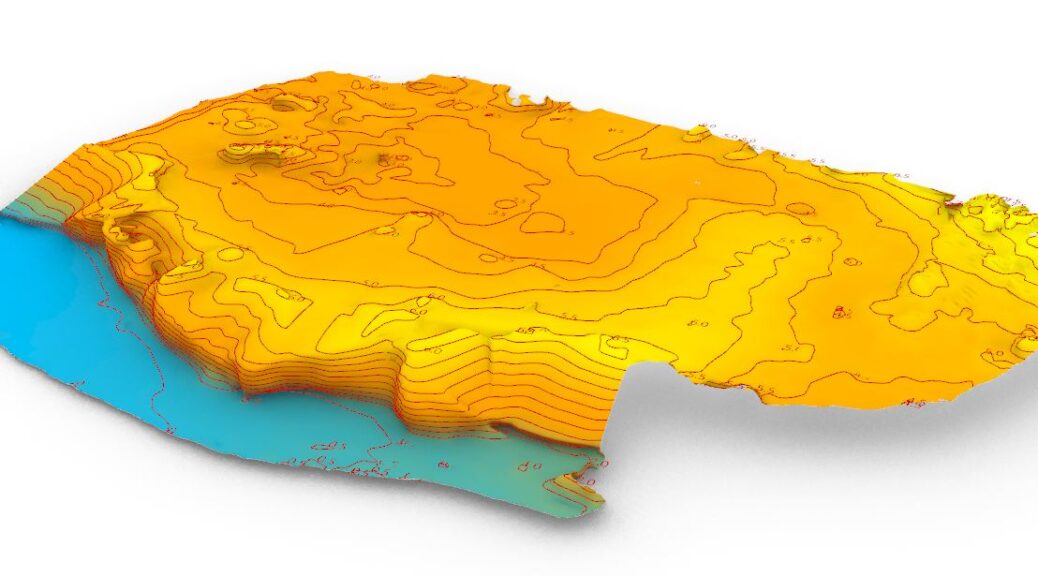
Exporting the 3D model, drawing the contour lines will be our goal. First we remove the trees and buildings from the original 3D.
Exporting the 3D model, drawing the contour lines will be our goal. First we remove the trees and buildings from the original 3D.
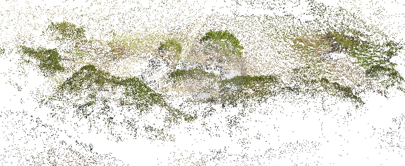
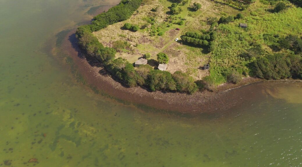
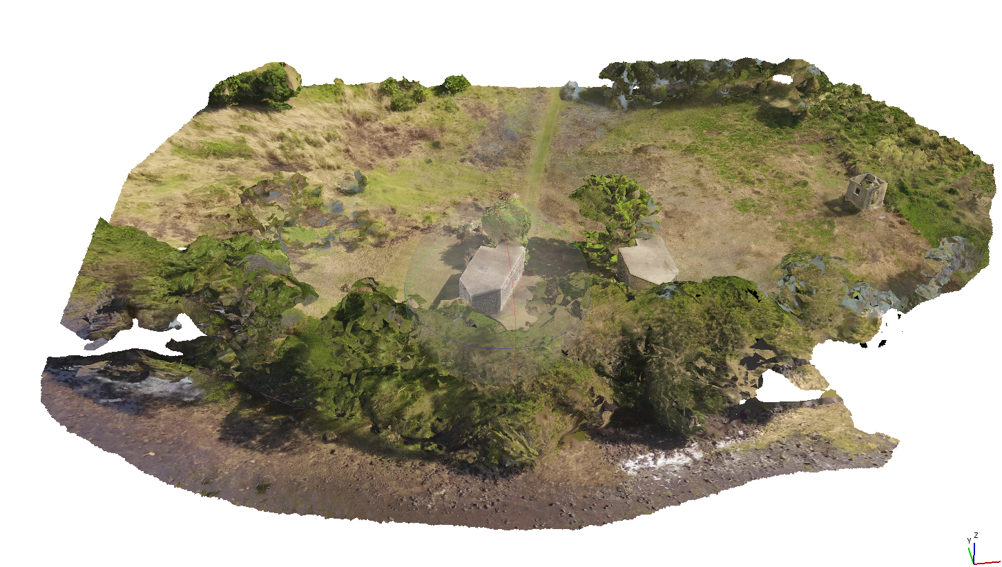
When information about a site is not available, it is interesting to make a survey by drone to realize a photogrammetry. The photogrammetry will allow to build a 3D model and to extract the necessary information to understand the site.
The preparation of the drone flight is essential. The flight must be able to cover the entire site from different angles. Otherwise, there would be deformations or missing information.
The example presented here presents the workflow for creating a 3D model from an aerial film shot with a drone and the processing of the data for further work.
Here, the drone was forced to work in sections. Here are the different views. The work to come will be to assemble the 3D file fragments. Continuer la lecture de Protogrammetry From Drone Survey
De par son héritage technique et son rapport à l’image, le cinéma immersif à 360° tente toujours de tenir des liens instrumentaux et méthodologiques avec le cinéma. Toutefois, l’observation et la pratique montrent que la modèle cinématographique ne correspond pas réellement et qu’il encombre même la progressive maturité des films à 360° immersifs.
Continuer la lecture de Temps et Espaces multiples dans le cinéma immersifs.